Skip to content
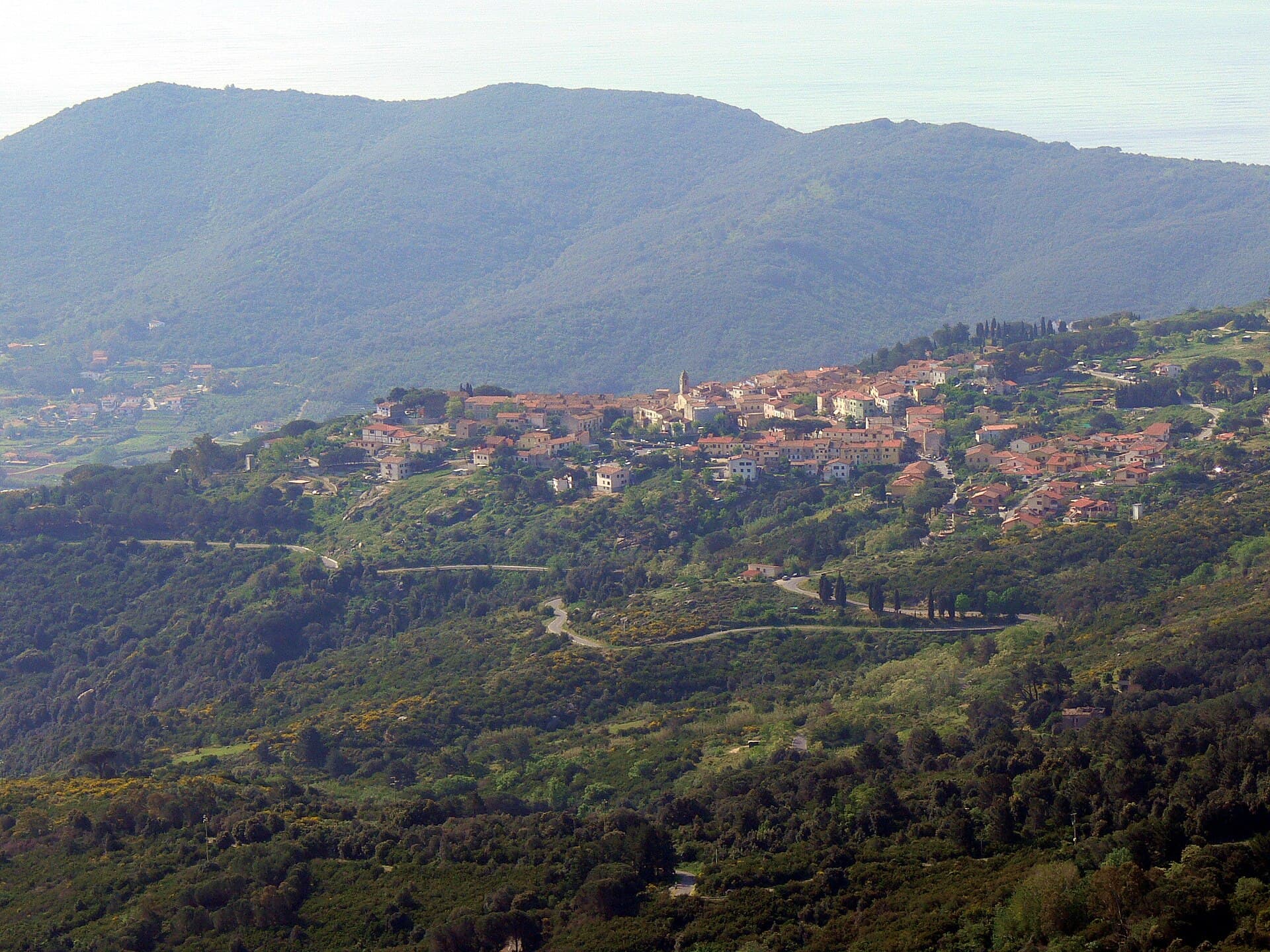
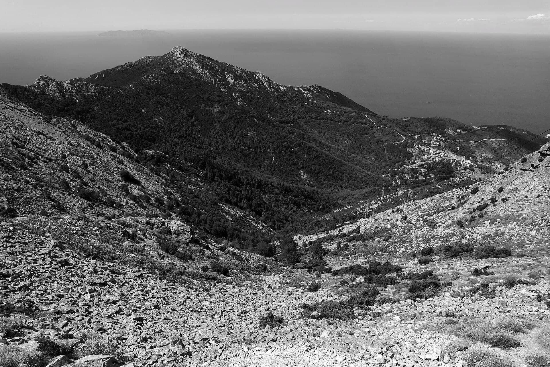
The view from the summit of Monte Capanne: granite ridges, woods and the open sea

Elba Island · on foot

Elba's walking trails

An island a thousand metres high in the middle of the sea. From a forty-five-minute walk to a four-day crossing — with the real times, not the brochure ones.

People who come to Elba for the sea almost always discover, on the third day, that the island also has a mountain: Monte Capanne reaches 1,019 metres and is the highest point in the whole Tuscan Archipelago. On a clear day you can see Corsica, Capraia, Montecristo and the Tuscan coast from up there, all at once.

The trail network is run by the Tuscan Archipelago National Park and it is well waymarked. There is everything: a cable car for those who want the view without the effort, a forty-five-minute via crucis, a 55-kilometre crossing and one equipped route that should be left to mountaineers.

Below are the walks we recommend most often, sorted by effort, with the distances and times the Park itself publishes. Each one has a map link: look at the place before you set off.

The summits

The two climbs that repay the most — and that you can do without being a walker.

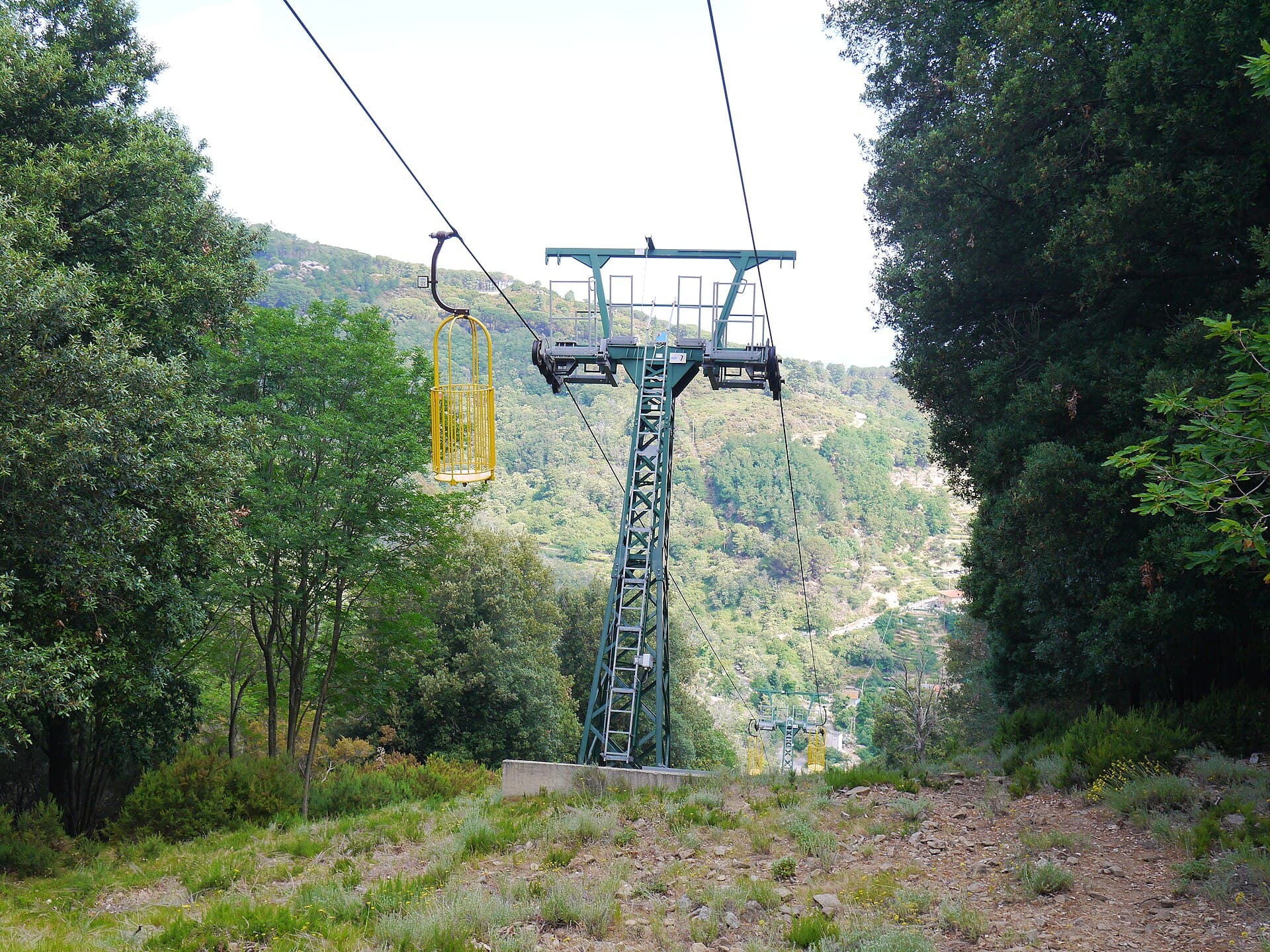
The yellow open cages of the Monte Capanne cable car among the woods above Marciana
The cabins are open cages, ridden standing · Simon de l'Ouest · CC BY-SA 4.0

Monte Capanne

1,019 m · cable car 18 min · on foot via path 101

The highest peak in the Tuscan Archipelago. There are two ways up, and neither is the wrong one.

The cable car leaves from Marciana, a few metres from the village centre at 375 metres, and reaches around 950 metres in eighteen minutes. It was rebuilt in 2005 and the cabins are open yellow cages that you ride standing up, one or two at a time: if heights bother you, know that first — if they don't, you will not forget it.

On foot, path no. 101 from Marciana is the main and simplest route: it climbs gently through a chestnut wood that gives shade even in July, and after about an hour and ten minutes it meets the GTE. Many people ride up and walk down — roughly three hours of descent.

Careful: the summit runs several degrees colder than the coast and the wind almost never stops. Bring a fleece even in August, and check the cable car timetable before going up.

See it on Google Maps
San Piero in Campo seen from Monte Perone, with the Capanne chain behind
Wolfgang Sauber · CC BY-SA 3.0

The Perone pass

630 m · reachable by car · short path to the top

The easternmost peak of the Monte Capanne chain, between Poggio and Sant'Ilario. The good thing about Perone is that you can drive there: the paved road climbs from Poggio through centuries-old chestnuts on the northern side, or up from the Marina di Campo side.

From the pass a short path — around five hundred metres — leads to a viewpoint from which you see both sides of the island at once. It is the place to understand Elba's geography in ten minutes of walking, which is why we suggest it on the first or second day.

For cyclists it is another matter entirely: the climb from Sant'Ilario or San Piero is considered the island's climb, about three kilometres averaging 10% with pitches of 16%.

See it on Google Maps

The long walks

One takes four days, one takes forty-five minutes. Both are worth it.

The Grande Traversata Elbana (GTE)

47–55 km · 4 stages · grade E (hiking)

This is the ridge line that crosses the island end to end, and the most important route in the Elban network: it links most of the island's paths together and, over four days, shows you how much Elba's geology, vegetation and shape change from east to west.

Near Monte Capanne it forks. Take the GTE Nord and you go from Cavo to Patresi: 55 kilometres, a little over 24 hours of walking. Take the GTE Sud and you finish at Pomonte: 47 kilometres, 19 and a half hours. To either you must add roughly 8 kilometres of link paths down to the villages at the start and end of each stage.

The classic four stages are Cavo–Porto Azzurro, Porto Azzurro–Procchio, Procchio–Poggio, and finally Poggio–Pomonte or Poggio–Patresi. It is not a via ferrata and you do not need to be a mountaineer — it is graded E, hiking — but it is a serious undertaking: it wants fitness, water, and a bed booked at every stage.

Careful: in summer the middle stages are exposed and have no fountains. The GTE is far better in April–May or October, when our homes are open anyway.

See it on Google Maps
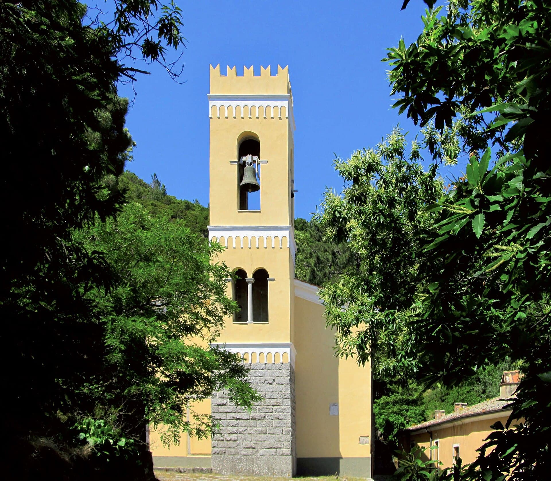
The bell tower of the Madonna del Monte sanctuary among chestnut trees above Marciana
Westernelba · CC0

The Madonna del Monte sanctuary

From Marciana · ~45 min on foot · uphill but easy

If we had to name one walk for someone who never walks, it would be this. You start in the village of Marciana and climb a wide, paved mule track, in shade, for a little under three quarters of an hour.

The climb is punctuated by fourteen tabernacles from the first half of the nineteenth century, decorated with scenes of the via crucis: you go up counting them, which is a very old way of measuring effort. At the top is the sanctuary, and in front of it a granite exedra fountain called the Teatro della Fonte, dated 1698, with three mascarons the water runs from. You drink there.

It is a quiet place among the chestnuts, and most visitors to the island never reach it. Marciana and Poggio, the two villages you start from, are among the loveliest on Elba and they sit in the mountains: a day up here is the exact opposite of the beach. That is rather the point.

See it on Google Maps

The world of granite

The western half of Elba is made of granite, and water and wind have been working on it for millions of years. Here you can have a stroll or a mountaineering route.

The rocks of San Piero

From San Piero in Campo · path 103B towards the Eagle

Above San Piero in Campo, since 2013, a marked route runs through monzogranite formations shaped by water and wind erosion. They all have names, because they really do look like what the name says: the Eagle, the Condor, the Crocodile, Napoleon's Horse, the Giant.

Following path no. 103B you reach the Eagle, and by scrambling onto the big granite boulders you open up a panorama that justifies the climb on its own. It is the most direct way to understand what this half of the island is made of — the same stone the Pisans built half of Tuscany with.

San Piero, where you start, has a twelfth-century church of Saints Peter and Paul built inside a fifteenth-century fortification: worth the stop before or after.

See it on Google Maps

Le Calanche

897 m · path 100 · grade EEA — expert equipped hikers only

The Calanche ridge is the watershed between the Marciana valleys to the north and those of Pomonte and Vallebuia to the south, and from a distance it is one of Elba's most recognisable sights: sheets of bare granite running down the crests.

We mention it because it is spectacular and because people ask — but it needs saying plainly what it is. Path no. 100, which runs along it, is the only trail in the Elban network graded EEA: expert hikers with equipment. It has exposed sections with an installed via ferrata, narrow passages between rock pinnacles, overhanging slabs and vertical climbs.

It is not a walk, which is why we do not file it with the others. If you have the experience, the gear and — better — a local mountain guide, it is the finest route on the island. If you do not, the view of Le Calanche is perfectly good from the Perone pass, in trainers.

Careful: path 100 = EEA, via ferrata and exposed sections. It requires a harness, helmet and ferrata kit, and the experience to use them. It is not suitable for children, beginners, or anyone who suffers from vertigo.

See it on Google Maps

How walking works on Elba

The right season

April, May, October and November are the trail months: right temperatures, scrub in flower, nobody about. In July and August you walk at dawn or you don't — Mediterranean scrub casts no shade.

Water, always more than you think

There are very few fountains on the trails and not all of them run in summer. A litre and a half each for half a day is the minimum, and there is nothing to buy on top of Capanne.

The trail numbers

The network belongs to the Tuscan Archipelago National Park and the paths are numbered and waymarked: 101 for Capanne, 100 along Le Calanche, 103B to the rocks of San Piero, 139 around Capo Poro. Photograph the Park map before you leave — phone signal comes and goes.

The grades, translated

T = tourist, anyone. E = hiking, needs a bit of fitness and real shoes: that is the GTE. EEA = expert equipped hikers, needs a ferrata kit: on Elba that means only path 100 along Le Calanche.

Frequently asked questions

Can you get up Monte Capanne without walking?

Yes. The cable car leaves Marciana at 375 metres and reaches around 950 metres in eighteen minutes. The cabins are open yellow cages you ride standing up, so bear that in mind if heights bother you. Many people ride up and walk down path 101, about three hours.

How long is the Grande Traversata Elbana?

It depends on the branch: the GTE with the GTE Nord runs from Cavo to Patresi, 55 km in a little over 24 hours of walking; with the GTE Sud you finish at Pomonte, 47 km in 19 and a half hours. Add roughly 8 km of link paths to the villages. It is walked in four stages.

Which is the easiest and loveliest walk?

The climb to the Madonna del Monte sanctuary from Marciana: three quarters of an hour on a shaded, paved mule track, punctuated by fourteen nineteenth-century tabernacles, with a granite fountain of 1698 at the top. It is uphill, but within reach of anyone who walks normally.

Is Le Calanche suitable for a family?

No. Path no. 100 along it is the only trail on Elba graded EEA — expert equipped hikers — with a via ferrata, exposed sections and vertical climbs. It requires a harness, helmet, ferrata kit and experience. To see Le Calanche safely, the view from the Perone pass is excellent.

When is the best time for hiking on Elba?

Spring and autumn. April–May and October–November give the right temperatures and empty trails; our homes are open from late April to mid-November, so they cover both windows. In summer, walk early in the morning.

Is there a walk that starts from Marina di Campo?

Yes, the Capo Poro loop on path no. 139: 4.6 km, 2 hours 15, 190 metres of ascent, graded easy, and you reach it on foot from the house. It passes the wild beach of Galenzana — we cover it on the page about the coves of our gulf.

A base in Marina di Campo, the whole island half an hour away

From Marina di Campo you reach Marciana and Capanne in half an hour by car, San Piero in ten minutes — and the Capo Poro loop starts in the village.

See the homes